Updated: 7:03 a.m. January 26, 2021
The snow is coming down steady and heavy in spots and the wind is really whipping. A band of heavy snow has developed over some of our northern communities. This area of heavy snow will mess up our snow forecast with over 6" of snow possible in these areas. The rest of southeast Wisconsin is seeing steady light to moderate snow.

Snow reports are starting to come in with most of southeast Wisconsin in the 2-6" range so far. At this point it looks like most of southeast Wisconsin will end up in a 4-8" range across the entire area including our northern counties.

The snow will stay steady through the rest of the morning. it will start to come to an end around noon in our western counties like Fond du Lac, Dodge and Jefferson Counties. Then our attention turns to lake effect snow that will linger lakeside through the afternoon and evening with a couple more inches of possible there. That lake effect band will push east and away from our area overnight.
------
Posted: 4:20 a.m. January 26, 2021
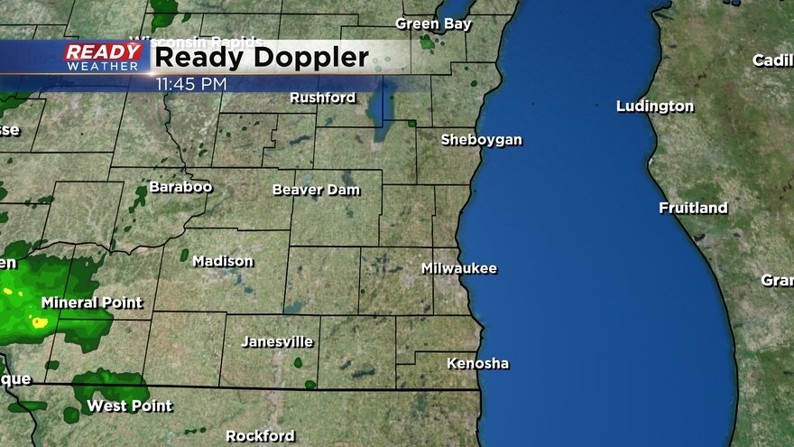
Steady snow moved in after 10 p.m. Monday night with most seeing steady snow by midnight. That snow has continued to stay steady Tuesday morning with light to moderate and even heavy snow at times. Here's the latest radar image that will update with time:
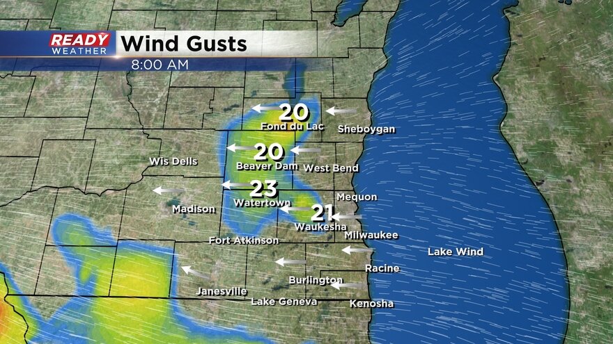
The wind is quickly becoming the bigger issue with strong gusts causing blowing snow and making road conditions even worse. A few spots have already seen wind gusts up to and over 30 mph this morning. Here are the current gusts:
For the first time this winter some kids are seeing their first snow day. Click here to see the list!
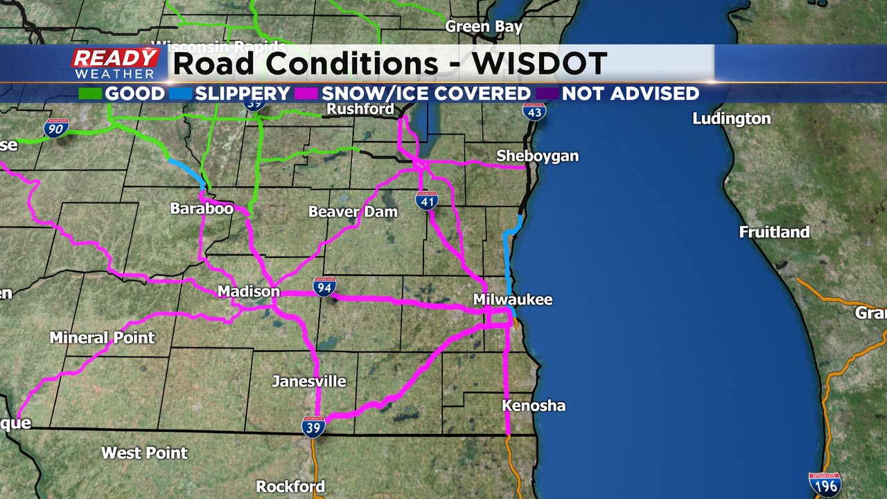
Road conditions are already pretty rough out there with snow covered roads reported across all of southeast Wisconsin. With heavy snow expected to be in place through the morning commute combined with blowing and drifting snow the roads will only get worse.
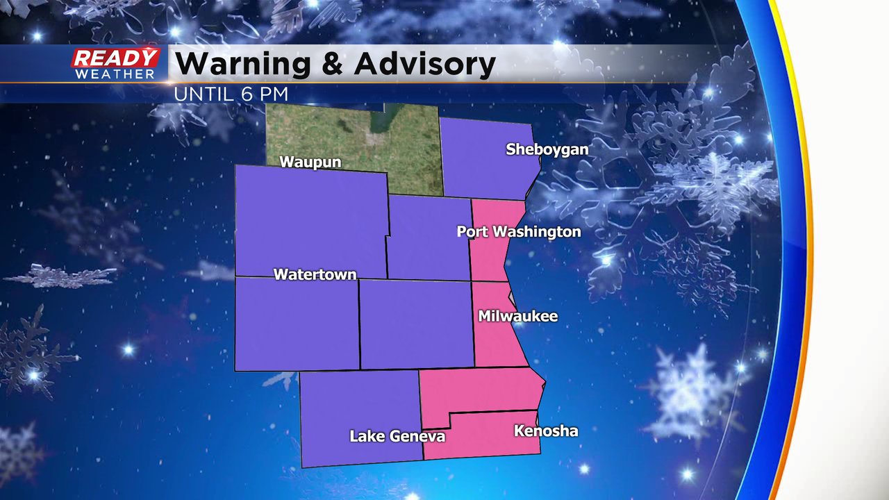
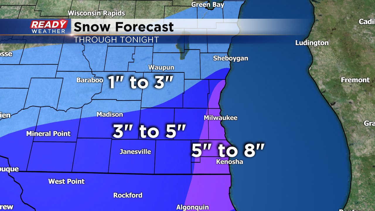
The forecast remains on track with steady snow expected for all of southeast Wisconsin all morning long. By noon the snow will begin to end in our western and northern counties but will linger with some lake effect for lakeside areas through the afternoon and early evening. Some light accumulation will be possible with that afternoon and evening lake effect but the bulk of the snow accumulation will happen before noon. A winter weather advisory (shown in purple) and a winter storm warning (pink) are both in effect through the late afternoon. Ozaukee County was added to the warning early Tuesday morning and Dodge County was added to the advisory Monday evening. Fond du Lac County is the only county not currently under an advisory or warning.
Snow totals still look on track with lakeside areas picking up the most with up to 8" possible there. Some inland and southern spots will see as much as 5" or 6" and northern and western locations will see the lowest totals with only a few inches there.
Download the CBS 58 Ready Weather app to track the snow all day.
"heavy" - Google News
January 26, 2021 at 08:07PM
https://ift.tt/3ofFYRn
7 AM Update: Heavy blowing snow continues, snow totals coming in - WDJT
"heavy" - Google News
https://ift.tt/35FbxvS
https://ift.tt/3c3RoCk
heavy
Bagikan Berita Ini


0 Response to "7 AM Update: Heavy blowing snow continues, snow totals coming in - WDJT"
Post a Comment