A series of storm systems and associated frontal boundary will bring multiple rounds of rain to the Mississippi Valley and the Southeast this week.
Heavy rain is on the way as the Mississippi Valley and Southeast brace for rounds of rain and potential flash flooding.
A series of storm systems and associated fronts will bring multiple rounds of rain to these regions and extend to the Gulf Coast this week.
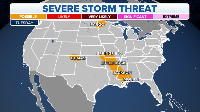
A weak front extending from the Southeast roughly northwestward to the Central Plains and upper-level impulses will produce showers and thunderstorms, with heavy rain over parts of Missouri.
(FOX Weather)
Storms were ongoing early Tuesday across Missouri and pose a risk for flash flooding through the morning hours.
HOW TO WATCH FOX WEATHER ON TV
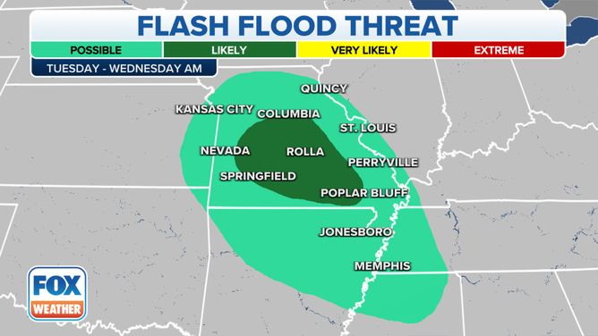
(FOX Weather)
"As meteorologists, whenever we look at water vapor, we like to look for those brighter colors. And when you start to get into those brighter colors, that is an indication of the amount of moisture in the air," FOX Weather meteorologist Jason Frazer said.
Looking at the water vapor map, the deepest blues west-northwest of St. Louis is a good reason why the FOX Forecast Center anticipates seeing some flash flooding Tuesday.
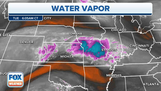
Here's a look at the water vapor in the air over the central U.S. at 6:05 a.m. Central time Tuesday.
(FOX Weather)
By Tuesday afternoon, this complex of showers and storms will slowly shift south, reaching the lower Mississippi Valley by Tuesday evening.
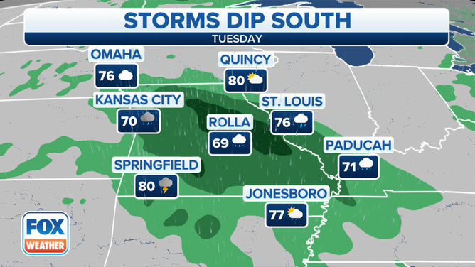
The heavy rain Tuesday will create mainly localized areas of flash flooding, with urban areas, roads and small streams the most vulnerable.
(FOX Weather)
"Later on tonight, we're going to get round two for those of you in Missouri," Frazer said. "Joplin, Missouri, will likely end up seeing some of these cells move through, then extending into Jonesboro, Arkansas."
HOW HEAVY IS IT REALLY GOING TO RAIN?
The round of storms will eventually make its way into Louisiana and Mississippi by Wednesday afternoon.

As the front settles farther southward on Wednesday, tropical moisture will aid in producing showers and thunderstorms over the Gulf Coast states and into the Southeast.
(FOX Weather)
A widespread 2 to 3 inches of rain is expected through Wednesday evening, and amounts as high as 5 inches are possible.
By Thursday, the focus of the heaviest rain will shift into the Deep South and remain there into the weekend.
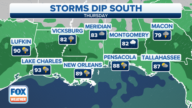
A risk of excessive rainfall is expected over parts of the lower Mississippi Valley eastward to the Southeast from Wednesday into Thursday morning.
(FOX Weather)
"heavy" - Google News
August 16, 2022 at 06:32PM
https://ift.tt/C4hcNeQ
Heavy rain, flash flood threats eye mid-Mississippi Valley, Gulf Coast, Southeast this week - Fox Weather
"heavy" - Google News
https://ift.tt/oKENwa1
https://ift.tt/LeXu1Yl
heavy
Bagikan Berita Ini


0 Response to "Heavy rain, flash flood threats eye mid-Mississippi Valley, Gulf Coast, Southeast this week - Fox Weather"
Post a Comment