Courtesy Montgomery Co. Fire and

WTOP/Dave Dildine
WTOP/Melissa Howell

WTOP/Melissa Howell
WTOP/Melissa Howell
WTOP/Melissa Howell
WTOP/Neal Augenstein
Weather Alert: A flash flood warning is in effect until 12:45 p.m. for Anne Arundel, northeastern Prince George’s, and southeastern Baltimore counties. Locations impacted include Baltimore City, BWI Airport, Annapolis and the Naval Academy.
Weather Alert: A flash flood warning is in effect until 11:30 a.m. for south central Anne Arundel, northwestern Calvert, Prince George’s and northeastern Charles counties. Locations impacted include Bowie, Clinton, National Harbor and Andrews Air Force Base..
Weather Alert: A flash flood warning is in effect until 11 a.m. for St. Mary’s and southern Calvert counties. Locations impacted include Leonardtown, St. Marys City and Lexington Park.
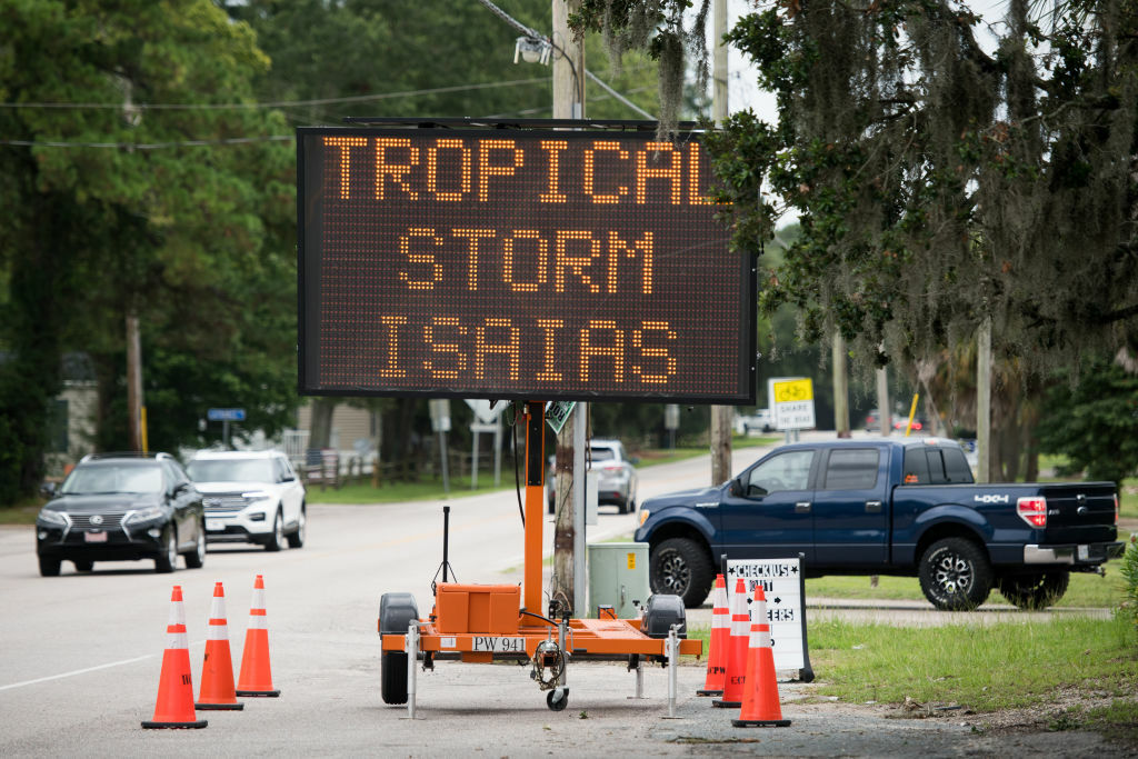
Isaias is racing up the East Coast, dumping between 2 and 6 inches in much of the D.C. region and spawning numerous tornadoes from Central Virginia through Southern Maryland — though the worst of the storm appears to be past us.
Tropical Storm Isaias — which made landfall in North Carolina last night as a hurricane with winds near 85 mph — continues to bring a flood threat to millions along the Interstate 95 corridor.
Forecasters are still warning of a flood risk in the District, Baltimore and the suburbs, though the storm’s heaviest bands are clearing out of the area and conditions near the nation’s capital should rapidly improve around noon as Isaias’ center crosses over the Delmarva.
Here’s what you need to know:
- It’s (almost) over: Heavy rainfall is wrapping up in Northern Virginia but continues to fall steadily in Eastern Maryland. Most of the region should be well on its way to clearing by noon, with peeks of sunshine even possible from D.C. to the south.
- …unless you’re on the coast: Isaias is pushing a large volume of water behind it, meaning coastal flooding of between 3 and 5 feet will continue to be an issue for low-lying areas of the Chesapeake and the Eastern Shore through tonight.
- Travel headaches: Torrential rain sent smaller streams and rivers over their banks near the District into Southern Maryland. High water on some area roadways, downed trees and wind restrictions on bridges are sure to make travel tough for a while.
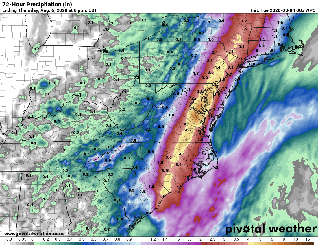
Isaias is moving quickly as it cuts across the Chesapeake, dumping up to 6 inches of rain in the WTOP listening area while speeding off to the north — with a lasting risk for flash flooding and power outages.
The storm’s center will track to the east of D.C. mid to late morning, when winds will pick up to between 40 and 50 mph near the nation’s capital, peaking close to 70 mph around Annapolis and Southern Maryland. National Weather Service meteorologist Chris strong called it an “increasingly dangerous situation.”
Rain from Isaias overspread the area around midnight like expected, but the storm is also proving a prolific tornado producer from southeastern Virginia into southern Maryland.
Intense thunderstorms spawned at least nine suspected tornadoes overnight from Southern Maryland to the Hampton Roads area of Virginia.
In Suffolk, Virginia, multiple homes were damaged by falling trees, and city officials received reports of a possible tornado. A fire station downtown sustained damage including broken window, and photos posted by city officials showed a pile of bricks lying next to a damaged business.
DOWNTOWN SUFFOLK DAMAGE: Storefronts along W Washington street took a hard hit during the storm. This is the Brandon House. Most of the front windows are blown out. A look at the damage coming up on #13newsnow pic.twitter.com/vv9oZt3KH1
— Allison Bazzle 13News Now (@13AllisonBazzle) August 4, 2020
Trees were downed, cars were crushed and at least one home damaged in the vicinity of Lexington Park, Maryland, after a tornado was sighted near Leonardtown just before 7 a.m. according to a report submitted to the weather service.
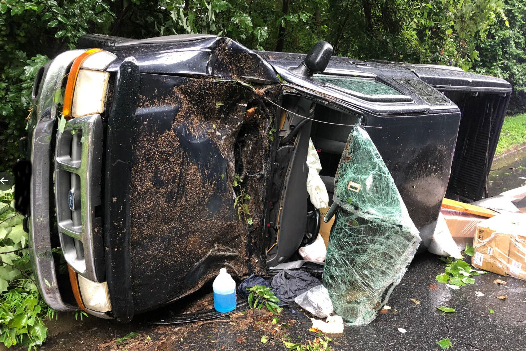
Isaias’ winds brought a tree down on a moving vehicle on West Lake Drive near Tuckerman Lane in Rockville. One person was transported to a hospital with injuries not considered life threatening, Montgomery County Fire and Rescue spokesman Pete Piringer said, tweeting photos of an overturned truck:
ICYMI (~910a) On W. Lake Dr. near Tuckerman Lane, Single vehicle struck by a falling, @MCFRS_EMIHS transported 1 adult NLT, @mcfrs PE726, A726 responded (MCFRS move the tree out of roadway) https://t.co/PuPMudMEpI pic.twitter.com/1XzLgv5J8K
— Pete Piringer (@mcfrsPIO) August 4, 2020
Thousands of outages have been observed in Northern Virginia. More than 115,000 customers are in the dark throughout the whole state, particularly from Richmond to Virginia Beach, who were among the first to face the brunt of Isaias in the overnight hours.
Washington and Northern Virginia had seen between 2 and 4 inches of rain by 10 a.m. Tuesday according to radar estimates, with St. Mary’s and Calvert counties in Maryland eyeing the highest totals in the region with estimates of over 6 inches. The NWS had yet to release official rainfall totals.
The St. Mary’s River topped its banks to near-historic levels, forcing a closure on Md. Route 5 in Callaway.
Gallery: Isaias hits the Washington area
Mass transit and roads
Traffic on the Chesapeake Bay Bridge has been completely stopped in both directions due to high winds.
In Washington, Metro will limit some access to riders as part of its severe weather plan. The Cleveland Park Metro station will be closed Tuesday, since that station’s entrances are in an area prone to flash flooding. The north entrance to King Street station will be closed.
Riders are advised of the potential for weather-related delays and should anticipate service adjustments, though Metro said it plans to operate on a normal schedule.
VRE is operating on an S schedule. All trains marked with an “S” in addition to Fredericksburg line trains 300 and 307 are running.
Heavy rainfall will likely lead to widespread high water on flood-prone highways as Isaias’ heavier bands continue to move in. Remember: Turn around, don’t drown — only a foot of rushing water is enough to strand some vehicles.
Flooding is hampering traffic on I-295, where southbound commuters are being diverted to the exit ramp at Malcolm X Avenue to avoid high-standing water. Eastbound travelers on I-66 should avoid the left side of the highway before US-50/Fairfax (Exit 57) due to water described by a listener as “impassable.”
In Owings, northbound Md. Route 4 is closed after Route 2 due to flooding. Chesapeake Beach Road is also closed for high water both ways south of Solomons Island Road.
For the latest road and traffic conditions, see WTOP’s traffic page or listen to updates every 10 minutes online or on the air at 103.5 FM. Submit traffic tips by calling 866-304-WTOP or tagging @WTOPtraffic on Twitter.
Preparing for severe weather
Power companies across the D.C. area have been preparing ahead of the storm and advise those in the storm’s path to do the same.
D.C. coronavirus testing sites, as well as several in Virginia and Maryland, are closed on Tuesday in anticipation of bad weather.
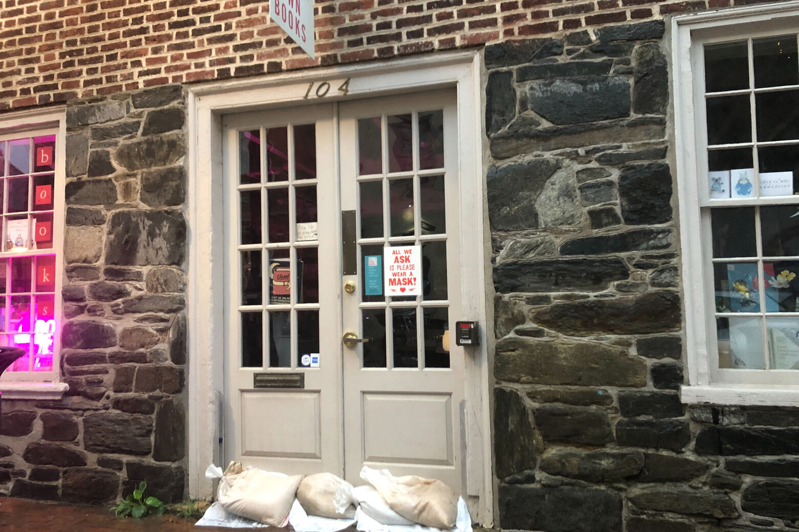
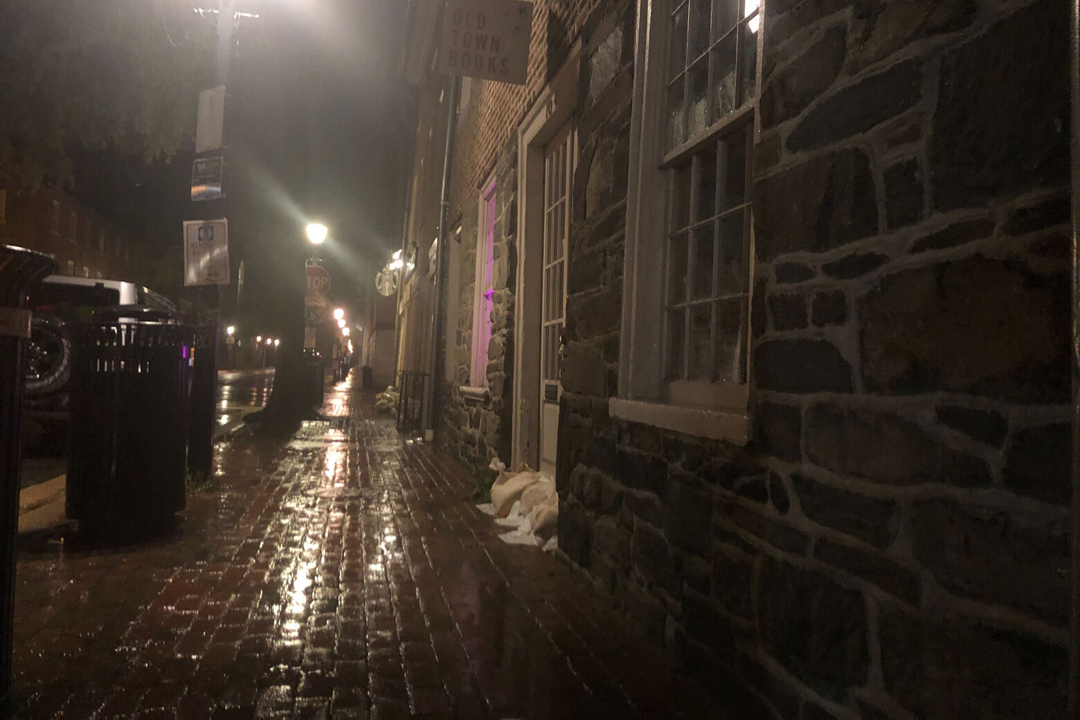
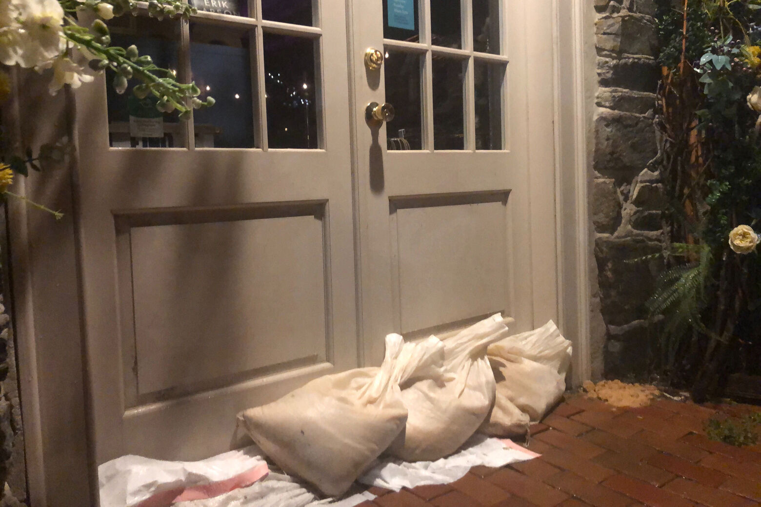
Ray Whatley, acting emergency manager for the city of Alexandria, Virginia, said they’ve been warning and helping those at the end of King Street, which has seen extensive flooding before. Storm preparation included bringing in tables added for outdoor dining during the pandemic.
In Virginia Beach, much of the city will be closed Tuesday, so people will be encouraged to stay home, Deputy City Manager for Public Safety Steve Cover said.
The southern area of Virginia Beach is prone to flooding from wind-driven tides, and Cover said high-water vehicles are in position in the area in case people need to be evacuated.
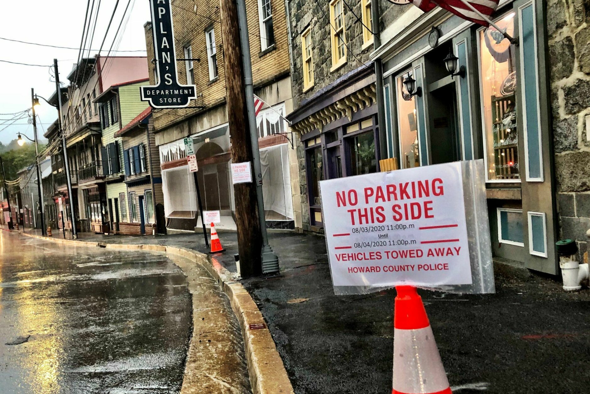
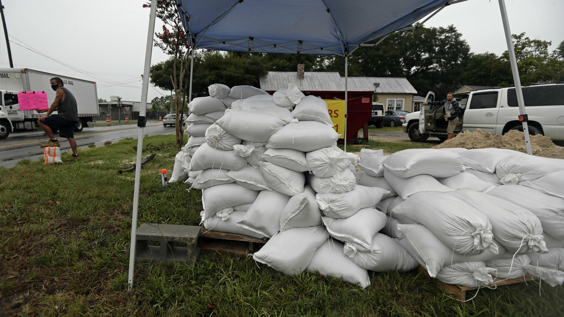
Ellicott City, Maryland’s Main Street is preparing for the worst, as the area is still recovering from recent floods.
The area is still recovering from devastating floods in 2016 and 2018. The Ellicott City Safe and Sound project has removed 12 tons of debris from streams in the watershed over the past year and a half to help prevent flooding in the area.
Tiber River, which flows along Main Street is higher/faster than a few hours ago, but culverts, sewers are handling rain so far in historic (and flood-prone) Ellicott City. Stay @WTOP for weather updates. pic.twitter.com/jXYqrQ5USp
— Neal Augenstein (@AugensteinWTOP) August 4, 2020
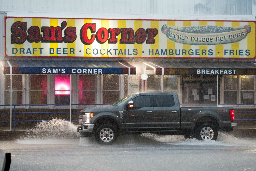
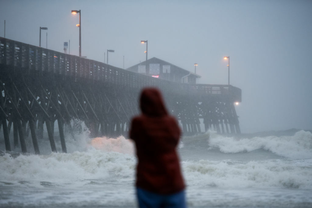
Isaias killed two people in the Caribbean and roughed up the Bahamas but remained at sea as it brushed past Florida over the weekend, providing some welcome relief to emergency managers who had to accommodate mask-wearing evacuees in storm shelters.
The storm set off flooding and sparked five home fires at the site of its landfall in Ocean Isle Beach, North Carolina. More than 500,000 customers have lost electricity, most of them in North Carolina and Virginia. At least one person was killed when a twister hit a Carolina mobile home park.
Sand from Topsail Beach, NC covering cars like it’s snow after #Isaias passed through last night. pic.twitter.com/pEESIf5Rx4
— Zack Green (@zackgreenwx) August 4, 2020
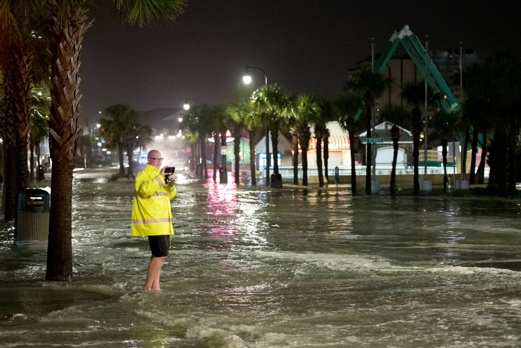
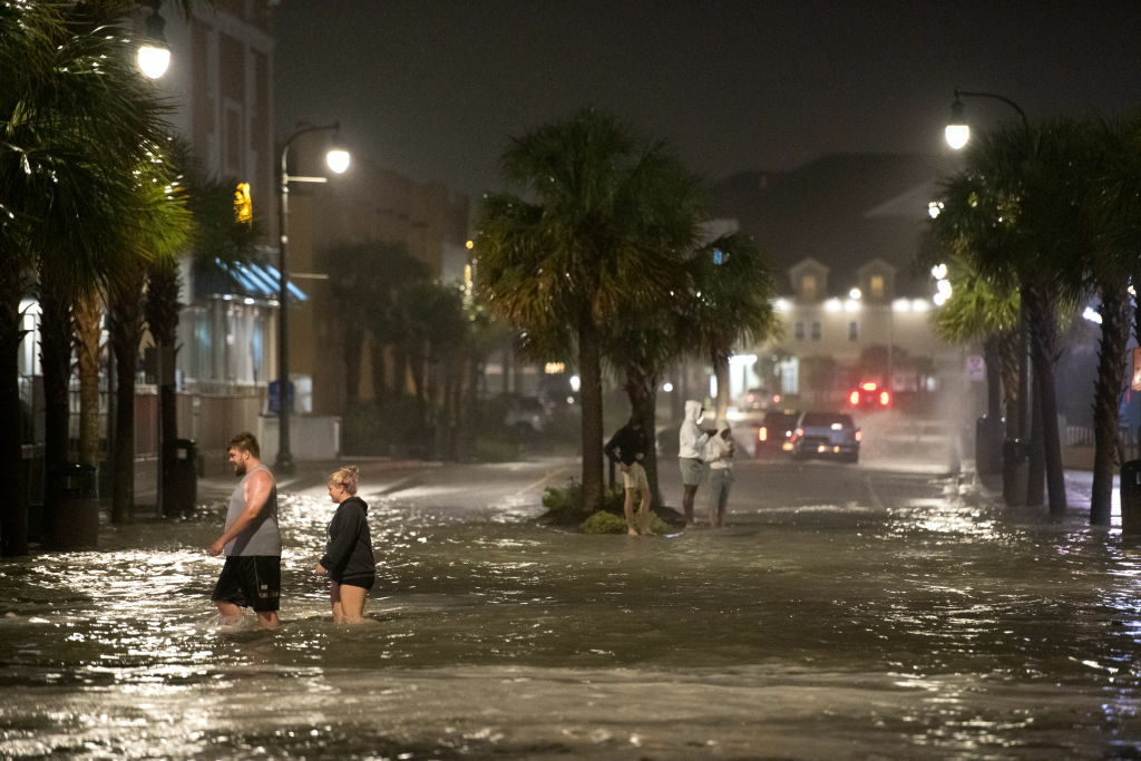
As the storm neared the shore, a gauge on a pier in Myrtle Beach recorded its third highest water level since it was set up in 1976. Only Hurricane Hugo in 1989 and Hurricane Matthew in 2016 pushed more salt water inland.
The predicted storm surge and wind gusts left dozens of boats piled up against the docks in Southport, and many decks facing out on the water were smashed. People were out Tuesday morning raking debris or picking it up with their hands and dropping it in trash cans.
Sand from Topsail Beach, NC covering cars like it's snow after #Isaias passed through last night. pic.twitter.com/pEESIf5Rx4
— Zack Green (@zackgreenwx) August 4, 2020

AP/Gerry Broome

AP/WECT_TV
Getty Images/Sean Rayford
Getty Images/Sean Rayford
Getty Images/Sean Rayford

AP/JASON LEE

Getty Images/Sean Rayford
Getty Images/Sean Rayford
AP/Gerry Broome
Getty Images/Sean Rayford
WTOP’s Valerie Bonk, Dan Friedell, Kristi King and The Associated Press contributed to this report.
Forecast
Tuesday: Tropical storm conditions with steady rain and strong wind gusts, especially in coastal areas. Highs in the upper 70s.
Wednesday: Mostly sunny and less humid as Isaias moves north. Highs in the mid-80s.
Thursday: Sunny, with a chance of showers and thunderstorms. Highs in the mid-80s.
Friday: Partly cloudy, with showers and thunderstorms likely in the afternoon. Highs in the mid- to upper 80s.
Current conditions
Power outages
"heavy" - Google News
August 04, 2020 at 07:33PM
https://ift.tt/3kesvYW
‘Expect blinding rain’: Isaias brings heavy downpours, tornado threat to DC area - WTOP
"heavy" - Google News
https://ift.tt/35FbxvS
https://ift.tt/3c3RoCk
heavy
Bagikan Berita Ini


0 Response to "‘Expect blinding rain’: Isaias brings heavy downpours, tornado threat to DC area - WTOP"
Post a Comment